
For much of the twentieth century, the modern city announced its competence by making water disappear. Rain fell on roofs, roads, and parking lots; it entered drains; it moved through underground pipes; and, if the system performed as expected, most residents never had to think about it again. This model was attractive because it was orderly. It treated stormwater as a technical inconvenience to be collected and discharged as quickly as possible. Yet the same model has become increasingly fragile. Heavier downpours, expanding paved surfaces, aging pipes, and expensive real estate have exposed a simple weakness: a city that gives water no place to pause eventually discovers that water will choose its own place. The new question in urban planning is therefore not how to defeat water, but how to make room for it without surrendering the city.
The old promise of drainage
Conventional drainage systems were built around a reasonable historical assumption: if rainwater could be removed quickly, urban life could continue with minimal disruption. Pipes, culverts, channels, and detention basins still perform essential work, and no serious planner argues that cities can replace them with gardens. The problem is that the older promise of drainage was often interpreted too narrowly. Water was treated as a volume to be transported, not as a force shaped by land use, soil, vegetation, social policy, and maintenance budgets. In dense neighborhoods, even a short storm can become dangerous when most surfaces are impervious and every roof, street, and driveway sends runoff to the same overloaded network.
This is why flood risk cannot be understood only as a matter of rainfall. Two districts may receive the same storm, yet experience very different outcomes. One may have mature trees, absorbent open space, raised utilities, and streets designed to slow runoff. The other may have compacted soil, undersized drains, basement apartments, and few public spaces where water can safely collect. The storm is the trigger, but vulnerability is produced over many years by decisions that appear ordinary at the time: where housing is permitted, which roads are widened, how parks are funded, and whether maintenance is treated as infrastructure or as an optional expense.
A flood is not only excess water; it is also evidence of where a city has hidden risk.
A different logic
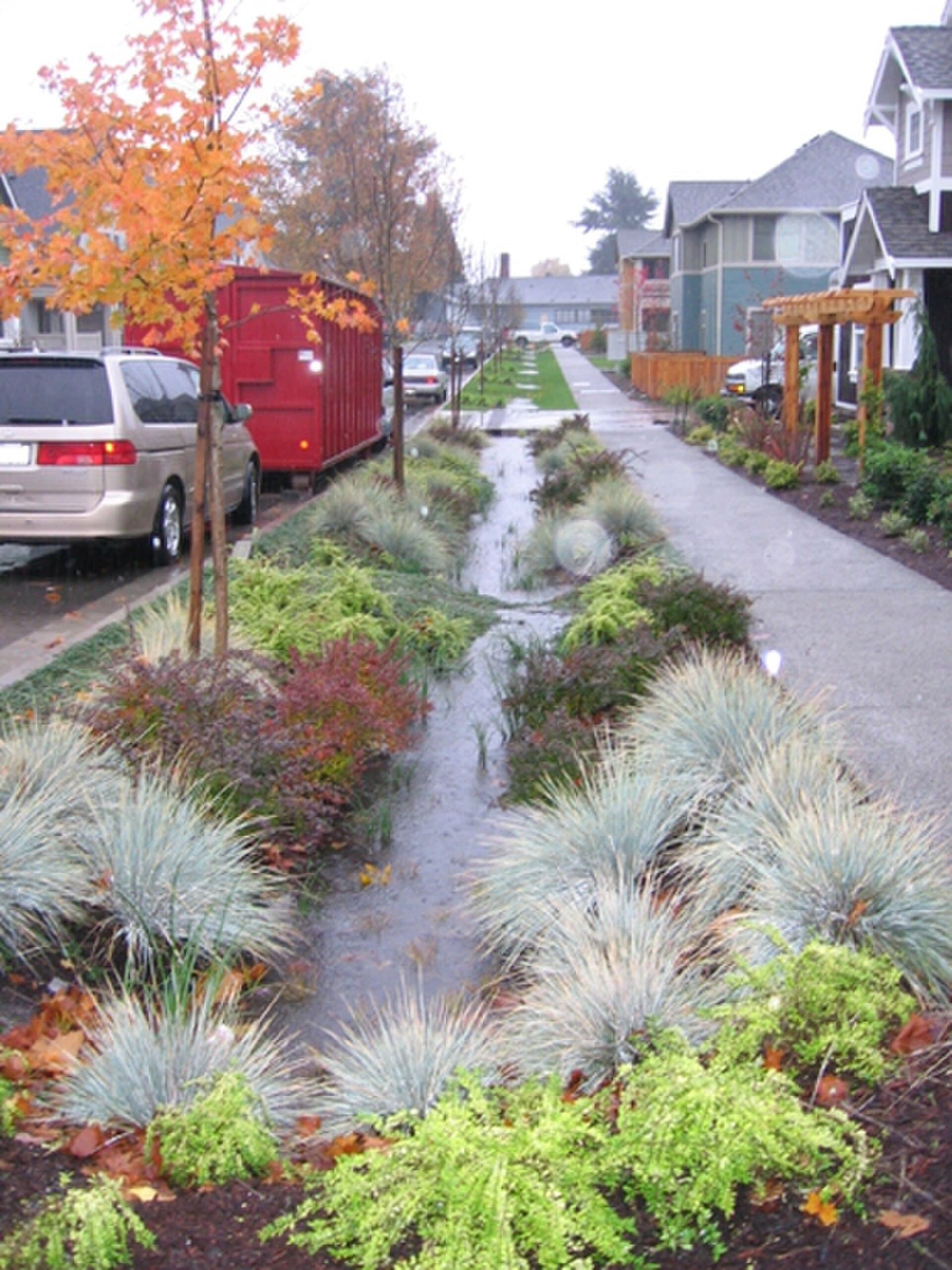
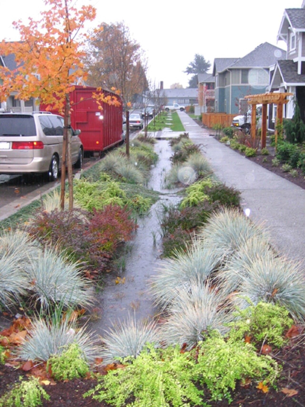
The contemporary approach to flood resilience begins with a different logic. Instead of asking every drop of rain to leave immediately, it asks some of that water to infiltrate, some to evaporate, some to be stored temporarily, and some to move more slowly through the landscape. This is the principle behind green infrastructure and nature-based solutions. Rain gardens, bioswales, tree trenches, permeable pavements, restored wetlands, and stormwater parks are not decorative additions to engineering. They are distributed forms of storage and delay. Their value lies partly in physical performance, but also in redundancy. A pipe has a fixed capacity; a neighborhood with many small absorbent features can fail more gradually and recover more easily.
The shift is intellectual as much as technical. In the older model, the successful city was dry because water had been pushed out of sight. In the emerging model, the resilient city is legible because the movement of water is visible and planned. A lowered sports field may become a temporary basin during an extreme storm. A widened curb may feed a planted swale rather than a drain. A restored floodplain may protect downstream homes by accepting water that would otherwise arrive as a sudden peak. These designs require a public conversation that is more honest than the language of control. They do not promise that floods will vanish. They promise that damage can be reduced because overflow has been anticipated.
What green infrastructure actually does
Green infrastructure is sometimes misunderstood because its components look modest. A rain garden beside a sidewalk does not resemble a major public work. It has no dramatic wall, gate, or control room. Yet its function is precise: it receives runoff from nearby hard surfaces, holds it briefly in a planted depression, allows part of it to soak into the ground, and filters pollutants before the remaining water enters a larger system. Multiplied across a catchment, such features can reduce peak flow, improve water quality, and make streets cooler and more pleasant. The effect is cumulative, which means the planning challenge is less about one iconic project than about many ordinary interventions placed in the right locations.
- Capture: absorbent soils, vegetation, cisterns, and green roofs hold rainfall close to where it lands.
- Delay: swales, basins, and floodable parks slow the arrival of water into pipes and rivers.
- Clean: plants and soils help filter sediment, nutrients, metals, and other pollutants carried by runoff.
- Relieve: distributed storage reduces pressure on older gray infrastructure during intense storms.
However, green infrastructure should not be romanticized. It works best when it is designed, inspected, and maintained with the same seriousness given to bridges or treatment plants. A clogged inlet can make a rain garden useless. A poorly chosen plant palette can fail during drought or repeated inundation. A permeable pavement can lose capacity if sediment is allowed to accumulate. The deeper lesson is important: a concept may be environmentally attractive and still require institutional discipline. Resilience is not achieved by replacing concrete with plants; it is achieved by combining ecological processes with accountable public management.
Why the problem is political
Flood adaptation often appears to be a technical subject, but it quickly becomes political because it asks who should bear inconvenience before a disaster occurs. A vacant lot that could store stormwater might also be attractive to developers. A road diet that creates space for bioswales may be criticized by drivers. A policy that restricts construction in a floodplain may reduce future losses while angering landowners today. These conflicts explain why many cities continue to invest heavily in emergency response while underinvesting in prevention. The benefits of prevention are diffuse and delayed; the costs are immediate, visible, and usually assigned to a department, taxpayer, or property owner.
The most mature flood strategies therefore combine physical design with governance. They map risk honestly, update building codes, protect natural storage areas, fund maintenance, and coordinate agencies that are often separated by bureaucratic boundaries. Transportation departments, housing authorities, parks departments, water utilities, and emergency managers all shape flood outcomes, even when they do not describe their work as flood policy. A city that plants trees but continues to approve vulnerable basement units has not solved the problem. A city that builds a stormwater park but cannot maintain it has created a temporary symbol rather than durable capacity.
The central issue is not whether a city can afford resilience; it is whether the city can recognize prevention as infrastructure before the bill arrives as disaster.
Equity cannot be an afterthought
A further difficulty is that flood resilience can unintentionally widen inequality. Neighborhoods with political influence are often better positioned to attract tree planting, street redesign, and park investment. Meanwhile, lower-income residents may live in older housing, near industrial corridors, or in low-lying areas where insurance is expensive and drainage is poor. If adaptation funding follows property values or complaint volume, it may protect the already protected. A serious resilience plan must therefore ask not only where water flows, but also where social vulnerability concentrates. Exposure, sensitivity, and recovery capacity are different dimensions of risk, and all three matter.
Equity also changes the meaning of public participation. Residents are sometimes invited to comment after a design has already been chosen, which turns participation into decoration. A more credible process asks communities what has flooded before, which routes become unsafe, where older residents need assistance, and which public spaces feel neglected. Local knowledge cannot replace hydrological modeling, but it can correct the blind spots of models that see elevation and pipe diameter more clearly than household income, language access, disability, or informal caregiving networks. In practice, the best flood maps are both technical and lived.
A practical definition of resilience
The term resilience is sometimes used so broadly that it loses precision. In the context of urban flooding, it should mean the capacity to reduce harm before a storm, maintain essential functions during the storm, and recover without pushing costs onto the least protected residents afterward. This definition is deliberately practical. It does not require a city to become invulnerable, which is impossible. It requires the city to lower predictable losses, design for overflow, and treat recovery as part of the system rather than as a separate act of charity. Resilience is measured not by whether streets remain perfectly dry, but by whether danger, disruption, and recovery burdens are limited and fairly shared.
For language learners preparing for academic exams, this topic is especially useful because it combines environment, technology, economics, and public policy. It also rewards careful reading. The strongest argument is not that green infrastructure is superior to gray infrastructure in every case. It is that cities need a broader vocabulary of response. Pipes move water, wetlands store it, trees intercept it, parks can safely receive it, and policy determines whether these pieces support one another. The city of the future will not be the city that keeps water invisible at all costs. It will be the city that has learned where water belongs.
Academic vocabulary
- impervious: describing a surface, such as asphalt or concrete, that water cannot easily pass through
- runoff: rainwater that flows across land or pavement instead of soaking into the ground
- infiltrate: to enter or pass through soil or another material
- redundancy: extra capacity in a system that helps it continue working when one part is overloaded
- vulnerability: the degree to which people, places, or systems can be harmed by a hazard
- governance: the way decisions are coordinated, funded, enforced, and made accountable
Sources and images
- U.S. Environmental Protection Agency. Soak Up the Rain: The Benefits of Green Infrastructure. https://www.epa.gov/soakuptherain/soak-rain-benefits-green-infrastructure
- Federal Emergency Management Agency. Building Community Resilience with Nature-Based Solutions: A Guide for Local Communities, June 2021. https://des.mt.gov/Mitigation/Mitigation-Documents/fema_riskmap-nature-based-solutions-guide_2021-1.pdf
- Rain Garden (14418205110). U.S. EPA / Clarion Associates, public domain via Wikimedia Commons. https://commons.wikimedia.org/wiki/File:Rain_Garden_(14418205110).jpg
- Mississippi River flood near Bayou Gauche, Louisiana, May 1973. U.S. EPA / National Archives, public domain via Wikimedia Commons. https://commons.wikimedia.org/wiki/File:IN_THE_SPRING_OF_1973_THE_MISSISSIPPI_RIVER_REACHED_ITS_HIGHEST_LEVEL_IN_MORE_THAN_150_YEARS._UNPRECEDENTED_FLOODING..._-_NARA_-_552811.jpg


